
Changes in forest cover composition of Boswellia papyrifera (Del.) Hochst. stands and their consequences, South Kordofan, Sudan
Abstract
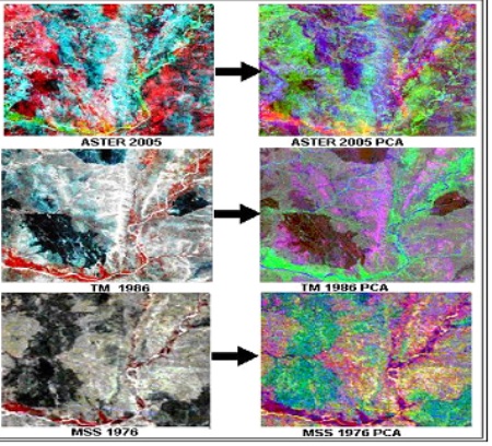
Forest cover change of Boswellia papyrifera (Del.) Hochst. stands in South Kordofan State was assessed using remote sensing imagery of Landsat MSS (Multispectral Scanner), TM (Thematic Mapper) and ASTER (Advanced Space-borne Thermal Emission and Reflection Radiometer) level-1B. Cluster random sampling along the accessible sites was carried out. Both unsupervised and supervised classifications for each image separately were carried out. Then post-classification comparison approach was used. The resulting classified images were comprised of evergreen forest, deciduous forest, barren land, Boswellia species including Combretum sp., Acacia sp. and shrubs and grass. Best classification results were obtained with Principal Component Analysis. The final results were presented in the form of change maps and matrices. There was a change in the areas of all classes with significant decrease in Boswellia class and dramatic increase in the classes of bare land, plantation, Combretum, shrubs and grass. The direction of change is towards Acacia wood land. Forest cover change can be assessed with high accuracy using multi-temporal remotely-sensed data and field sampling. Post-classification comparison approach seems to be efficient, although its high accuracy relied partially on image dates, accurate ground control points and analyst knowledge of the geographical region.Â
Full Text:
PDFReferences
H. M. El Amin, Trees and Shrubs of the Sudan, Ithaca Press, Biddles Ltd, Guildford and Kims Lynn, England, 1990.
K. Vogt, A field worker’s guide to the identification, propagation and use of common trees and shrubs of the Sudan; (SOS) Sahel international London, UK. 1995.
M. A. Khamis, Assessing the Potentials of Boswellia papyrifera stands for Sustainable Management in Southern Kordofan State, PhD Thesis, Juba University, Sudan, 2008.
W. Ogbazghi, The Distribution and Regeneration of Boswellia papyrifera In Eritrea, British Ecological Society, Journal of Applied Ecology, 43, (2006), 1188-1195
N. Marshall, Searching for a cure Conservation of medicinal wildlife resources in East and Southern Africa. September 1998. A TRAFFIC Species endangered report, Nairobi, Kenya. 1998 pp.3.
V. Soraya Emergency Early Warning and Response Space Applications. Master Seminar, Mario Gulich Institute, CONAE. Argentina, 2013 pp. 1.
R. B. Thapa, M. Shimada, M. Watanabe, T. Motohka and T. Shiraishi, The tropical forest in South East Asia: Monitoring and scenario modeling using synthetic aperture radar data. Applied Geography (41), (2013), 168-178
J. A. Richards, and X. Jia, Remote sensing digital image analysis Springer, Berlin, Germany. 1999
R. M. McCoy, Field Methods in Remote Sensing. The Guilford Press, New York London. 2005.
P. Coppin, I. Jonckheere, , K. Nackaerts, and B. Muys, Digital change detection methods in ecosystem monitoring, a review. International Journal of Remote Sensing, 25 (9): 2004 1565-1596
R.G. Congalton, and K. Green, Assessing the accuracy of remotely sensed data: Principles and practices. Lewis Publishers, New York: 1999 137 p.
J. R. Jensen, D. J. Cowen, J. D. Althausen, S. Narumalani, and O. Weatherbee,. An evaluation of the coastwatch change detection protocol in South Carolina. Photogrammetric Engineering and Remote Sensing, 59 (6): 1993, 1039-1046.
J. R. Anderson, E. E. Hardy, J. T. Roach, and R. E. Witmer, A land use and land cover classification scheme for use with remote sensor data. Geological survey professional paper 964, US Geological Survey, Washington, DC. 1976
D. Yuan, and C. Elvidge, NALC land cover change detection pilot study, Washington D.C. area experiments. Remote Sensing of Environment, (66), (1998) 166-178.
Refbacks
- There are currently no refbacks.